Robert Paulus Wins GeoSpatial Award 2024
On December 16, 2024, Robert Paulus, a PhD student in our team, was honored with the GeoSpatial Award 2024, organized by Flagis. This award recognizes his outstanding master thesis titled:
“Spatio-temporal modeling and crisis sensibility analysis using social media data”
About the Thesis
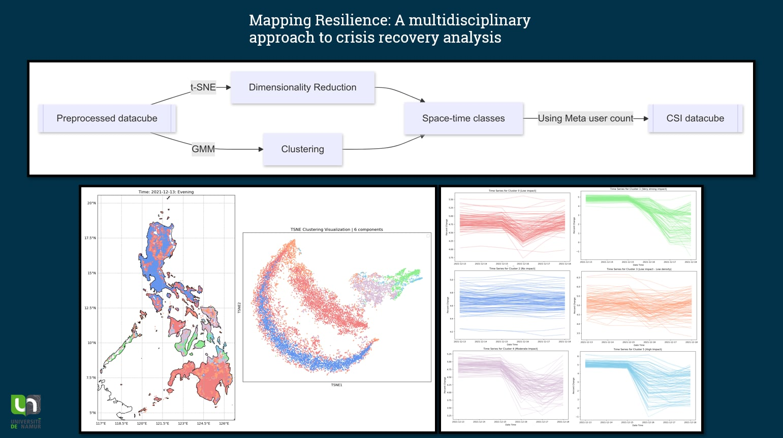
This interdisciplinary Master’s thesis bridges geography, data science, statistics, and machine learning to explore innovative approaches for maximizing the use of spatiotemporal data. Leveraging massive community-sourced data from Facebook—a prime example of big data—it focuses on user behavior in the Philippines during major climate crises, particularly typhoons.
Using advanced spatiotemporal statistical tools, the study identifies and categorizes population resilience to these disasters, highlighting variations based on location and proximity to the typhoon’s path. It uncovers response delays across affected areas and disparities in resilience, with some communities struggling to recover or facing prolonged impacts. These resilience classes are integrated with demographic indicators to create a spatiotemporal vulnerability index.
By combining insights from distinct scientific disciplines, this thesis offers a quantitative, objective approach to a complex issue. Its findings have tangible implications: improving crisis management by pinpointing areas of low resilience and high vulnerability for targeted interventions and informing public policies to enhance long-term climate resilience.
Recognition and Announcement
The award was presented during the annual GeoSpatial conference, organized by Flagis, a leader in geospatial solutions. The full announcement can be found on their official website: https://flagis.be/.
We are incredibly proud of Robert and his exceptional work, which exemplifies the innovative and interdisciplinary research being conducted within our team!